

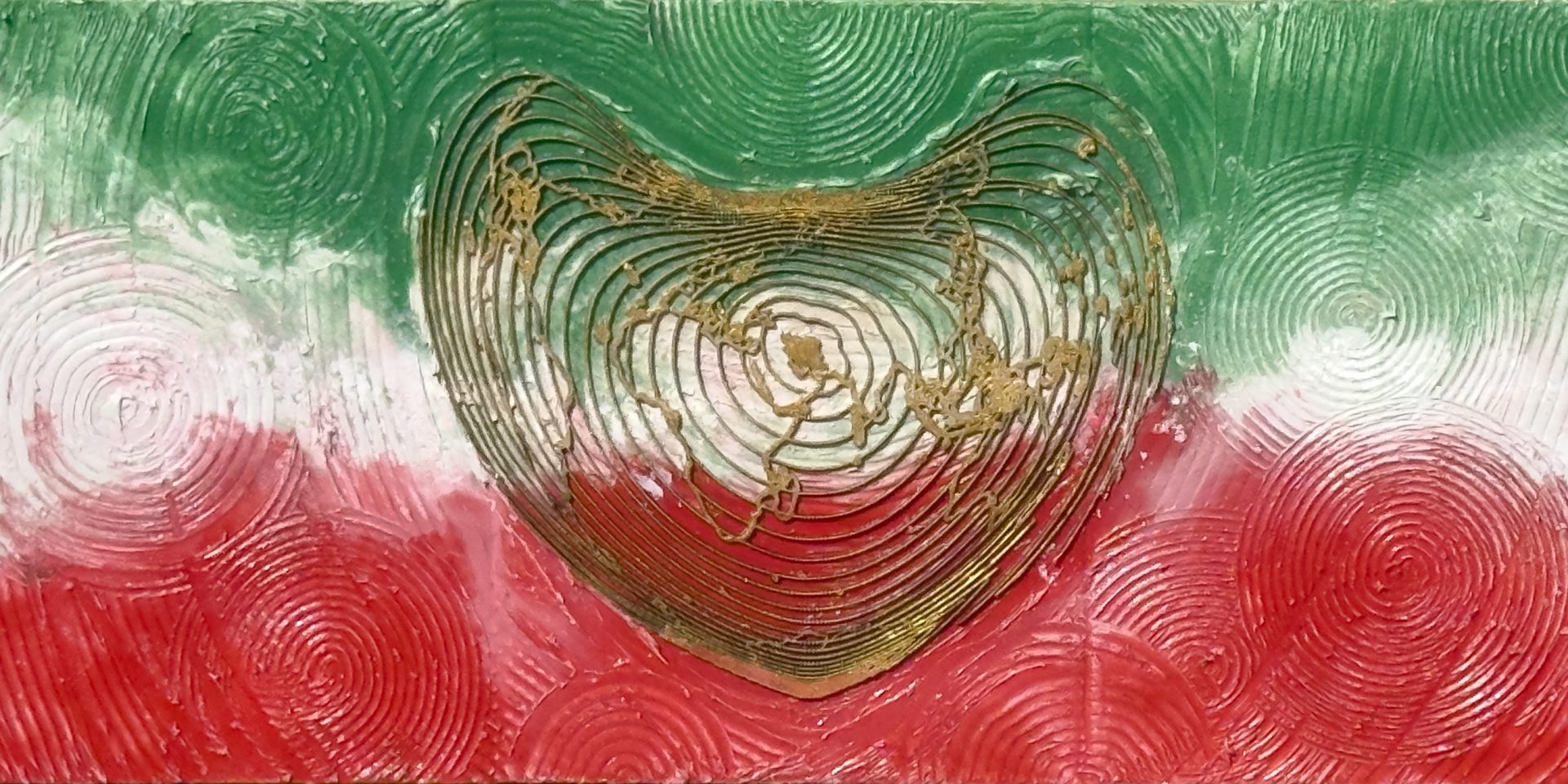
Fine Arts Meets GIS: How Geospatial Mapping Is Creating a New Form of Contemporary Art
For centuries, artists have interpreted the world through observation, imagination, and emotion. At the same time, cartographers and geographers have mapped landscapes through measurement, analysis, and scientific precision. Today, these two disciplines are increasingly intersecting, giving rise to a new creative practice where Geographic Information Systems (GIS) become more than analytical tools—they become sources of artistic inspiration.
This convergence is redefining how we understand landscapes, place, and environmental change. It is also shaping an emerging field known as GeoArt.
What Is GIS?
Geographic Information Systems (GIS) are digital technologies used to collect, analyse, manage, and visualise spatial information. Governments, planners, ecologists, engineers, and scientists use GIS to understand relationships between people, landscapes, ecosystems, and infrastructure.
GIS enables professionals to analyse:
- Landform and topography
- Vegetation patterns
- Hydrology
- Urban growth
- Biodiversity
- Climate impacts
- Environmental change
- Cultural landscapes
Traditionally, this information has been presented as technical maps, reports, and spatial models. However, these same datasets also contain remarkable visual complexity that can inspire artistic exploration.
When Science Becomes Art
Every landscape tells a story.
Elevation models reveal hidden landforms. River systems create natural compositions. Road networks resemble organic patterns. Satellite imagery captures colours and textures that often resemble abstract paintings.
By interpreting these spatial relationships creatively, GIS data becomes the foundation for fine art rather than simply scientific analysis.
Instead of communicating only measurements, the artwork communicates memory, place, environmental change, and the evolving relationship between people and nature.
What Is GeoArt?
GeoArt is an interdisciplinary practice that integrates GIS, cartography, remote sensing, landscape observation, and fine arts to create artworks inspired by geographic information.
Rather than reproducing maps, GeoArt transforms spatial data into artistic compositions while preserving the underlying identity of the landscape.
Each artwork may begin with:
- GIS spatial analysis
- Digital elevation models (DEMs)
- Satellite imagery
- Historical mapping
- Land use analysis
- Aerial photography
- Landscape interpretation
These datasets are then translated into paintings, mixed-media works, digital compositions, or installations that invite viewers to experience geography through an artistic lens.
Why GeoArt Matters
Many environmental issues are difficult to communicate using statistics alone.
Climate change, biodiversity loss, urban expansion, and landscape transformation often remain abstract concepts until they are experienced visually.
GeoArt provides another way of communicating these complex issues by connecting scientific evidence with emotional engagement.
When viewers recognise familiar coastlines, river systems, or urban forms within an artwork, they begin to appreciate the changing landscape from both scientific and cultural perspectives.
This connection between data and emotion can encourage greater public awareness of environmental stewardship.
The Creative Process
Every GeoArt project follows a journey that blends scientific rigour with artistic interpretation.
Research
The process begins by investigating a landscape using GIS, aerial photography, historical maps, and environmental datasets.
Spatial Analysis
Patterns within the landscape are identified through mapping techniques, revealing relationships that may not be visible from ground level.
Interpretation
Rather than producing a literal map, these spatial patterns are reimagined using colour, abstraction, composition, and texture.
Artistic Development
Multiple layers of paint, mixed media, or digital techniques are used to transform geographic information into expressive artworks while retaining the landscape’s identity.
GeoArt and Landscape Architecture
Landscape architecture has always balanced science, ecology, culture, and design.
GeoArt extends this philosophy beyond planning practice by exploring landscapes as both physical environments and cultural narratives.
The same spatial understanding used to analyse cities, ecosystems, and regional landscapes can also inspire creative works that celebrate place while encouraging environmental awareness.
Rather than separating science from creativity, GeoArt demonstrates that they are complementary ways of understanding the world.
Looking Beyond Traditional Landscape Painting
Traditional landscape painting often represents what the eye can see.
GeoArt explores what lies beneath the visible landscape.
Hidden geological formations, ecological systems, historic land uses, topographic relationships, and urban evolution become part of the artistic composition.
This approach offers viewers a deeper understanding of place—one informed by both scientific analysis and creative interpretation.
The Future of Contemporary Art
As spatial technologies continue to evolve through satellite imagery, drones, remote sensing, and digital mapping, artists have unprecedented opportunities to engage with geography in new ways.
GeoArt represents one possible future for contemporary art: a practice where environmental science, cartography, landscape architecture, and fine arts work together to tell richer stories about the places we inhabit.
In an era defined by climate change, biodiversity loss, and rapid urbanisation, creative practices that bridge science and culture will become increasingly important.
GeoArt demonstrates that maps are more than navigational tools—they are visual narratives capable of inspiring curiosity, reflection, and meaningful conversations about our relationship with the Earth.
About the Artist
Dr. Ata Tara is a landscape architect, visual planning consultant, and contemporary artist whose GeoArt practice combines GIS, spatial analysis, landscape architecture, and fine arts. His work transforms geographic information into abstract artworks that explore climate resilience, biodiversity, cultural landscapes, and the evolving relationship between people and place.
