
What Is GeoArt? From Geodesign and Spatial Data to Material Storytelling
Maps are usually made to explain where things are. GIS helps us understand how places work. Geodesign goes further, using spatial information to explore how landscapes might change.
But what happens when the map is no longer only an analytical tool?
What happens when spatial data becomes art, material and cultural expression?
This question sits at the centre of my evolving practice of GeoArt.
GeoArt is a form of GIS art and spatial storytelling that transforms geographic data, mapping and geodesign processes into artistic experiences. Rather than treating maps simply as finished graphics, GeoArt uses spatial layers, landscape information and cultural narratives as material for interpreting place.
From geodesign to GeoArt
My pathway to GeoArt began not in a conventional art studio, but through landscape architecture, GIS, landscape planning and geodesign.
Geodesign brings together geographic information, analysis and design to understand landscapes and explore possible futures. It works through layers: ecology, topography, infrastructure, culture, development, climate and many other spatial systems.
My GeoArt practice uses a related way of thinking, but changes the purpose.
Rather than using spatial layers primarily to arrive at a planning or design solution, I use them to construct an artistic narrative.
Geodesign uses spatial information to help design landscapes. GeoArt asks how spatial information itself can become a cultural and artistic experience.
The map therefore moves from analytical interface to emotional interface.
From GIS Art to GeoArt
GIS art often explores the visual and creative possibilities of geographic information. GeoArt extends this relationship by connecting spatial analysis with materiality, cultural interpretation and emotional experience. In my practice, the process often begins with geographic layers—landscape, infrastructure, history, climate or cultural information—which are interpreted, layered and eventually transformed into physical or visual artworks.
The map as material
GeoArt is not simply about making maps look artistic.
Materiality is increasingly central to the practice.
GIS layers may begin digitally, but they can leave the screen. Maps are printed, layered, cut, engraved, cast in resin, transferred to fabric or combined with other physical materials.
The spatial information remains present, but its role changes.
A coastline can become an edge.
A river can become a physical layer.
Topography can become texture.
A boundary can become a cut.
A spatial relationship can become a pattern.
The map becomes an object.
This transformation interests me because geographic information normally communicates through abstraction. Materialisation gives that information weight, texture, scale and physical presence.
Geography carries meaning
Spatial data is never entirely neutral.
A map can contain histories of settlement, migration, environmental change, political boundaries, cultural identity and relationships with Country and place.
GeoArt allows those meanings to be encountered differently.
In Naarm, mapping becomes a way of engaging with Melbourne through layers of place, landscape and cultural identity.
In Shamsa, Persian geometry and the symbolism of the sun intersect with mapping to connect geography with cultural memory.
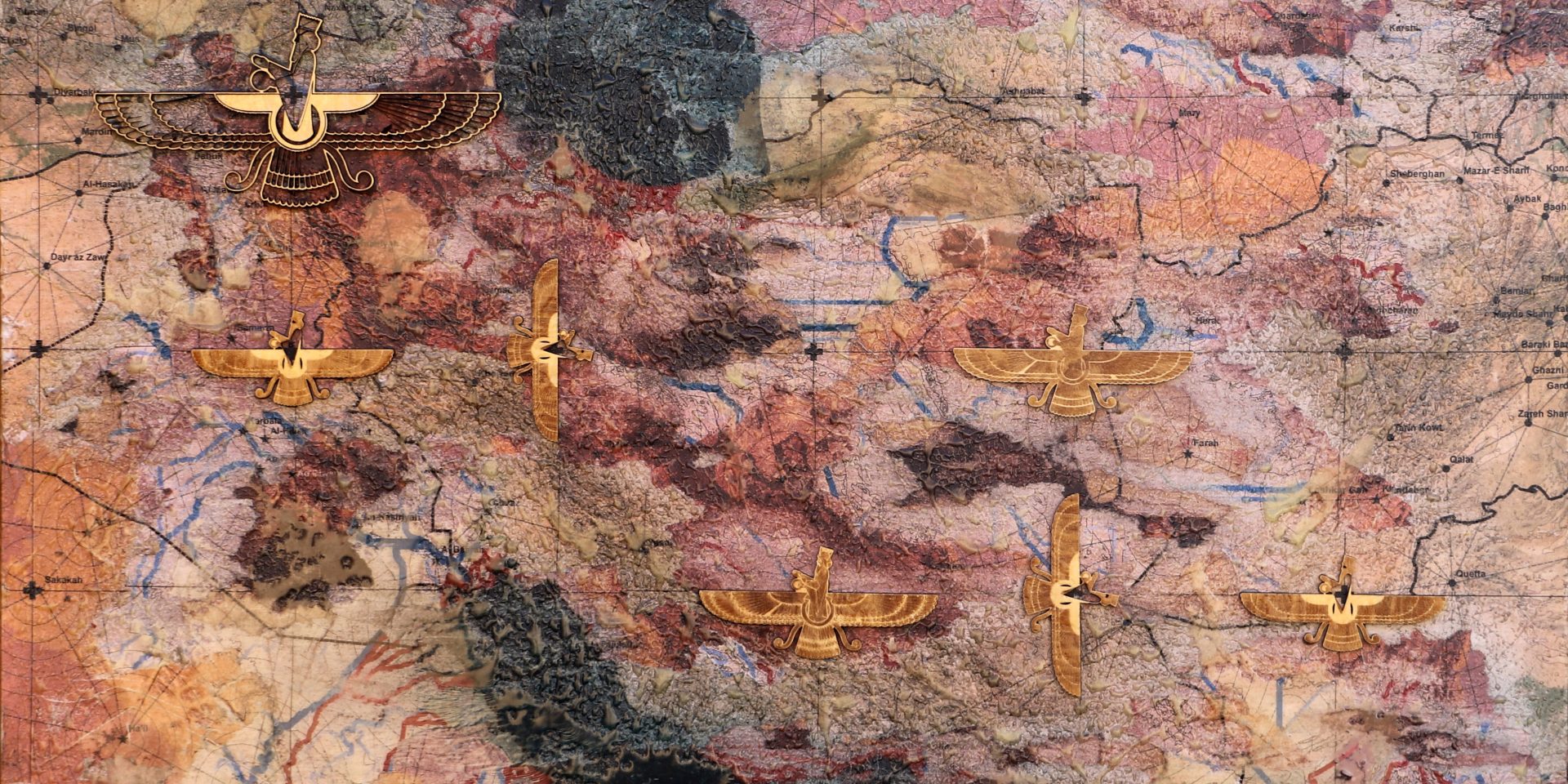
In Farvahar, Iranian symbolism is reconstructed through landscape and GIS layers, bringing cultural identity and physical geography into the same composition.
The geographic information is not simply background information in these works. It becomes part of their visual language.
From information to emotional interface
This leads to a larger question.
GIS and geodesign are extraordinarily powerful ways of understanding landscapes, but their outputs are often intended for specialists: planners, designers, scientists, governments and decision-makers.
Art creates another possibility.
Spatial information can become something people encounter intuitively before they necessarily understand it analytically.
A person may recognise their city, river, country or landscape. They may notice a familiar boundary or geographic form. That recognition can create curiosity, memory, attachment or disagreement.
I think of this as an emotional interface with spatial information.
GeoArt does not replace GIS, mapping or geodesign. It extends their communicative possibilities.
From maps on walls to geography we carry
The next stage of this exploration is moving beyond the wall.
My current collaboration with fashion designer Maryam Kalantary investigates what happens when mapped landscapes become wearable objects.
Spatial artworks are transferred onto garments, textiles and accessories. Geography moves with the body.
This changes the relationship again.
A map is no longer simply something we observe. It becomes something we choose to carry.
This has led us to a simple idea:
We like the geography we carry.
The proposition is both physical and emotional. Places can form part of identity, memory and belonging. Wearing geography makes that relationship visible.
Can art feed back into geodesign?
Perhaps the most interesting possibility for GeoArt is still unresolved.
If geodesign can generate GeoArt, could GeoArt eventually feed back into geodesign?
Could artistic interpretations of spatial information help communities engage with proposed landscape change? Could they reveal emotional responses that conventional mapping does not capture? Could exhibitions become another form of participation in spatial planning?
I have not fully operationalised this feedback loop yet, and I think it is important to be clear about that.
For now, much of my practice operates in the space between spatial analysis and cultural interpretation.
But that unresolved connection may be precisely where the future potential lies.
GeoArt as spatial storytelling
I therefore see GeoArt less as a particular visual style and more as a process.
It begins with geography.
It works through spatial information, mapping and layers.
It interprets those layers through cultural and artistic decisions.
And increasingly, it gives geography material form.
The outcome might be a print, a mixed-media artwork, a resin landscape, a laser-cut map, an installation or something worn on the body.
What connects them is not their medium.
It is the transformation of geographic information into cultural, material and emotional experience.
That is the territory I am continuing to explore through GeoArt.
This process can be seen across works such as Farvahar, Energy Landscapes in Transition and Geography of Heart:Australia, where spatial information becomes a way of exploring identity, environmental change and emotional relationships with place.
Explore the wider GeoArt Gallery.
